every Single Street of Treasure Island
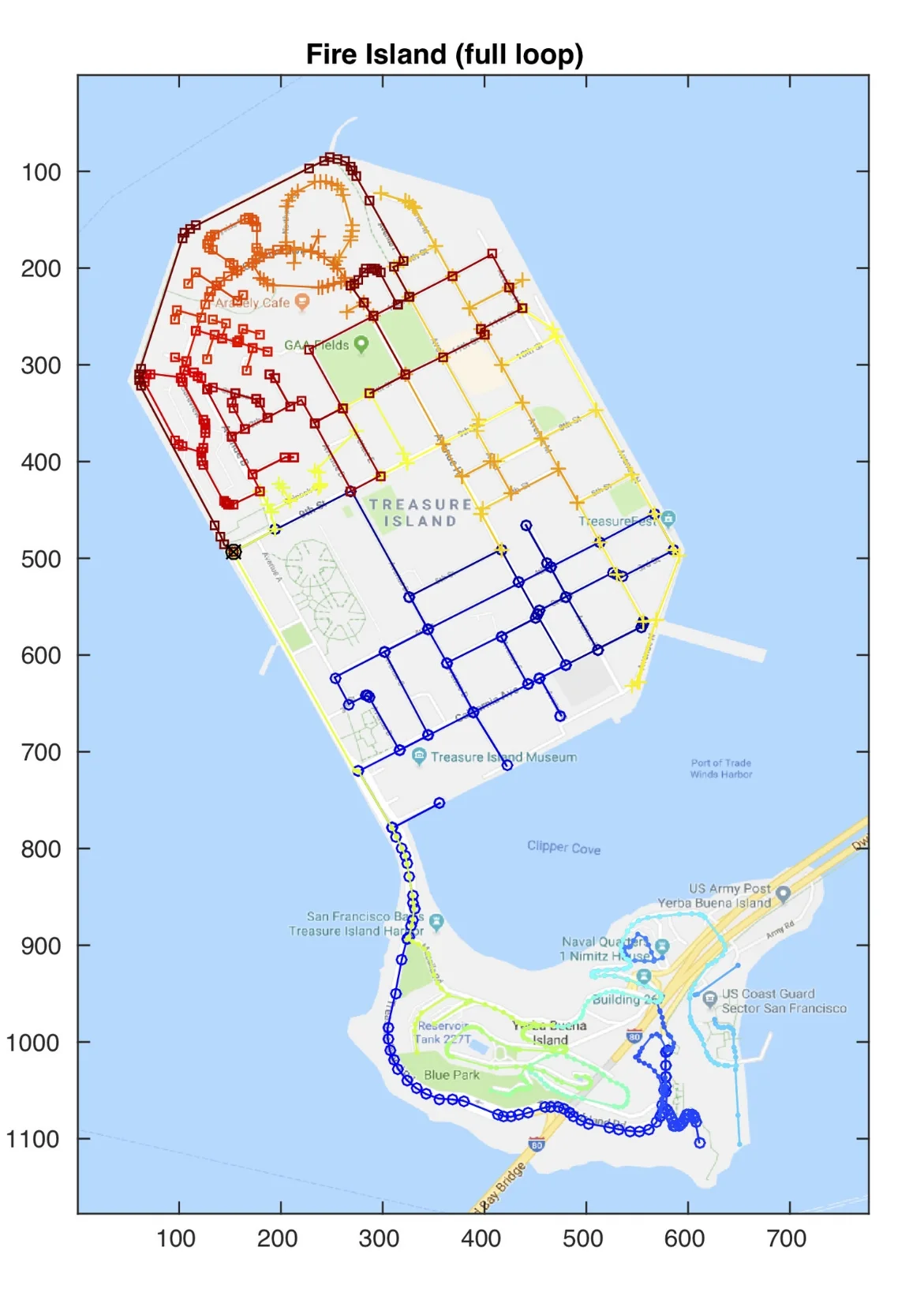
Michael Otte made this route and picture. Starting and finishing at the black X. Obviously either direction through the rainbow works, but the routes below follow the rainbow blue through red.
There are 23 miles of street on Treasure Island…
I’ve been collaborating with a longtime friend, Michael Otte, on how to run the the streets most efficiently. I’m going to tell you more about Mr. Otte and all that we’ve been working on, but before that, here is a set of four routes, in order (and Otte’s website ottelab.com). The second route begins where the first one ends, etc. The map above is the complete 23ish miles and more like 26 if you include the run down the bridge and back.
1: https://routes.rungoapp.com/route/AhpDjaN2ba
2: https://routes.rungoapp.com/route/0DTh7H7egS
3: https://routes.rungoapp.com/route/gk6ehRAEl2
4: https://routes.rungoapp.com/route/msDvl1EUMx
The running app gives you voice directions. It takes a little getting use to, but kinda nice to know that you will get all the streets and do them most efficiently.
Doing your own route is also an option. I print out a map and carry a pen with me to figure out where I’ve been and where I want to go. It can be pretty fun to figure out how to cover all the ground efficiently.